Our comprehensive report on surveillance in Canada is available. Download it here.
Trend 5 – Surveillance-by-Mobile
Until about five years ago, a favourite claim of Internet pundits was that new information and communication technologies (ICTs) would make geography irrelevant. They envisioned a world where new technology would allow us to easily communicate with people anywhere in the world, get the information and media we desire from anywhere, and work equally well in the office, at home, or in a café in Antigua. And while many of those things have come to pass, the surveillance capabilities embedded in the technologies that make such developments possible give new significance to geography—precisely because now we can be almost anywhere and still be contacted. This greater ability to track and locate individuals represents another key surveillance trend in Canada and elsewhere.
Consider how our cell use has changed over time. Not long ago, few of us would have begun a phone conversation with the question, “Where are you?” Phone numbers designated places, equivalent to street addresses. Today, with the omnipresence of cellphones, our caller could be almost anywhere on the planet. At the same time, the technology itself has a built-in need for (approximate) location data since calls must be routed to wherever the receiving phone happens to be.
In addition, our ability to pinpoint the location of a phone has improved. Early cellphone networks could locate a cellphone to within one hundred metres. Once the global positioning system (GPS) became publicly available in 2000,1 civilian users were given fine-grained positional data. Today, phones are capable of identifying their location within a range of two metres.2 And, as devices that can read GPS data have become cheaper, the previous divide between well-to-do cellphone owners and poor landline users no longer applies. Even the most basic “free” phone has a built-in ability to track our geographic location. In fact, as mobile devices become more powerful, many low-income consumers are abandoning personal computers altogether.3
This ability to locate cellphones is being replicated for other everyday objects through the use of RFID chips, which make these objects uniquely identifiable, as well as through the latest Internet Protocol systems, which make it theoretically possible to assign an IP address to nearly every object in the world. Sensors that can read RFID tags and share information about their location over the network will be embedded in our homes and offices, in public buildings, and in locations along the street, thereby enabling the movements of these objects (including human beings) to be mapped in real time. This is the much-hyped future “Internet of things,” where the physical world and informational flows will become layers in our daily existence. In that future, simply walking down the street will generate flows of information about minute details of our everyday interactions with our environment.
Developments such as these will multiply in the next few years because they ostensibly benefit both those who do the tracking and those who are tracked. They also represent a particularly significant and rapidly developing form of surveillance. In what follows, we explore a few important facets of the potential for mass geographic tracking of objects and people. We are concerned here with everyday, large-scale tracking and will not discuss police, intelligence, and other forms of tracking used in law enforcement—althougth this is certainly a key part of the surveillance puzzle. [link]
Continuous Versus Sporadic and Trace Geolocation
Almost any form of data gathering can reveal aspects of your location. Your credit, debit, and loyalty cards all situate you at specific places and times. If you use a card five times a day, someone could learn a good deal about your movements that day. After a few months of accumulated data, a precise picture of the spatial distribution of your main habits would be apparent.4 Access control cards or biometrics also pinpoint a person’s location, allowing his or her activities to be tracked and mapped. These processes are referred to as “geolocalization.” And while such activities are possible, we should be careful not to equate what is possible with what is really happening. Many of these complex analytical operations are probably not being undertaken and may not yet be doable at a reasonable cost. Location-based surveillance, however, is different from such efforts to develop a locational profile by piggybacking on other, previously existing systems. Location-based surveillance provides spatial data immediately, without the need for data-mining analysis. Whatever its ultimate goal, a location technology always produces location data.
Continuous vs Discontinuous Geolocation
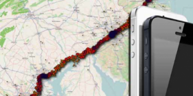
In order to receive calls, a portable phone must continuously inform its carrier’s system about where it is. Most phones do this by sending a roaming signal to nearby antennas. All carriers collect and keep these data for billing and other purposes. For example, they can be used to identify usage trends in order to plan for future infrastructure needs. Other potential uses are more nebulous. A recent mini-scandal involving Apple’s iPhones showed that Apple “location services,” which are part of the phone’s operating system, kept a full year’s worth of geolocation data in the device’s memory (although the information was not sent to Apple’s servers).
Truly continuous geolocation is seldom an efficient use of limited communication and computer resources. Much the same outcome can be secured through discontinuous geolocation—the practice of intermittently collecting data from a device. This involves recording significant or useful data, even though it does not produce a full record of a person’s movements. Because humans are creatures of habit, accumulating these discontinuous data over short periods of time—say, a few months—makes it possible to predict fairly accurately where someone will be at any time without the need for active tracking.
Discontinuous surveillance can occur when a device intermittently and automatically checks in and gives its position; most modern portable phones work this way. A roaming cellphone locates itself roughly in cells but can also triangulate its position with signals from multiple antennas or through its GPS unit if more precise positioning is required. There are numerous other examples of discontinuous geolocation and new technologies that sample our geolocation. For instance, some public transit cards or toll highway cards record your point of entry and point of exit in order to compute your fare or toll.
Finally, location data may exist simply as traces left on entirely unrelated activities. Twitter, for example, has been geotagging tweets since 2009. This means that every time someone tweets, Twitter records information about the location of the device used to create the tweet. Tweets can be searched and sorted based on this location information. Applications such as Twoogle Geo Search can use these data to map recent tweets around a specified location anywhere on the globe.5 Users can then be “followed” and their uploaded media consulted. Applications automating this process might draw quick profiles of people at certain locations or search for locations where people with specific profiles have gathered. Any photos taken outside of social media programs can also contain location data.
Conclusion
One final note. In the technologies described above, people are almost never tracked: it’s the devices that are tracked, whether phones, cars, RFID tags, or transponders. That the identified owners are carrying these devices is always drawn through inference with other data points, yet uncertainty remains.
There are two possible responses to these sources of uncertainty. The first is to increase tracking to the threshold where enough data are collected to establish identifiable, unique individual patterns. This does not require complete, uninterrupted tracking. Patterns developed using much less data offer near certainty that the same person is carrying the device. However, that person might not be the official, registered, or contracting owner of the device.
The second response is to replace device-unique IDs with user biometrics in order to link geolocation data directly to individuals rather than to their devices. It is already common for portable computers to offer fingerprint locking in order to protect their owners’ sensitive data. Microsoft’s Windows operating system has had a weak version of fingerprint locking for years. Manufacturers are also starting to include fingerprint recognition in smartphones and tablets. Some smartphones already have facial-recognition locks, but it is widely known that a photograph can fool this technology. The next generation of touchscreen biometrics will read fingerprints continuously as the user manipulates the phone or tablet, rather than only at the initial unlocking stage. In that case, any change of user will be recorded. If we push this biometrics and geolocation trend just a bit further into the future, we can imagine that new technologies, be they Google Glass or others, will recognize not only their users via iris recognition but also all faces around them, whether or not those being recognized are aware of this—and, obviously, whether or not they agree to it. Read the full trend in the free download of the Transparent Lives: Surveillance in Canada book.
- 1. It is no longer correct to refer to such a system as a GPS, since that is the specific name of the US military system. It is a global navigation satellite system, or a GNSS. In this study, however, we continue to use “GPS” because of its familiarity.
- 2. Anna Klimaszewski-Patterson, “Smartphones in the Field: Preliminary Study Comparing GPS Capabilities Between a Smartphone andDedicated GPS Device,” Papers of the Applied Geography Conferences 33 (2010): 270–79, http://www.academia.edu/353833/Geographic_Fieldwork_Preliminary_study_co....
- 3. Online Publishers Association, A Portrait of Today’s Tablet User Wave II, June 2012, http://www.atelier.net/sites/default/files/etude/utilisateurs_americains....
- 4. Daniel Ashbrook and Thad Starner, “Using GPS to Learn Significant Locations and Predict Movement Across Multiple Users,” Personal Ubiquitous Computing 7 (2003): 275–86.
- 5. See Twoogle Geo Search, http://twoogle.co.uk/.
